Unlocking the Secrets of the Sky: A Student's Guide to Weather Forecasting
Ever wondered how meteorologists predict whether you'll need an umbrella or sunglasses? It's a fascinating blend of science and observation that anyone can learn.

Have you ever woken up, looked out the window at a perfectly sunny sky, only to get caught in a downpour on your way home from school? It’s frustrating, right? It can feel like the weather has a mind of its own, and we’re all just guessing what it will do next. But what if I told you that weather forecasting isn't a guessing game at all? It’s actually a fascinating science, a huge puzzle that meteorologists (the scientists who study weather) are solving every single day.
Honestly, I used to think weather reports were basically magic. How could someone possibly know that a thunderstorm was going to roll in at 4 PM? After digging into it, I discovered that it all comes down to a few core principles. Understanding these basics is like learning the secret language of the sky. It’s a journey into how the sun’s heat, the air around us, and the water in our oceans and lakes all work together in a massive, interconnected system.
For students, learning about weather forecasting is more than just a neat science lesson. It’s about connecting with the world in a more meaningful way. It helps you understand why your region gets certain types of weather, how storms form, and why that forecast you see on the news is so incredibly complex. So, let’s pull back the curtain and explore the fundamental ideas that allow us to predict, with surprising accuracy, what the atmosphere has in store for us.
The Engine of Weather: Air Pressure and Temperature
At the very heart of all weather is a constant battle for balance, driven by two key players: temperature and air pressure. Think of the sun as the giant engine that starts it all. It heats the Earth, but it doesn't do so evenly. The equator gets blasted with direct sunlight, while the poles receive slanted, weaker rays. This simple fact creates massive temperature differences across the globe, and the atmosphere is always trying to even things out.
This is where air pressure comes in. You might not feel it, but the air above you has weight, and it's constantly pressing down. When air is cold, it's dense and heavy, so it sinks. This sinking motion creates an area of high pressure. I recently read on a NASA educational site that high-pressure systems are almost always associated with clear skies and calm weather because the sinking air prevents clouds from forming. It’s like a giant, invisible lid on the atmosphere.
On the flip side, when air is warm, it becomes lighter and rises. This rising motion creates an area of low pressure. As the air rises, it cools, and the moisture within it can condense to form clouds and, eventually, precipitation. This is why your local weather reporter might point to a big red "L" on the map when forecasting a rainy or stormy day. The constant movement of air from high-pressure zones to low-pressure zones is what we feel as wind. It’s the atmosphere’s way of trying to find equilibrium.
The Role of Water: Humidity, Clouds, and Fronts
If temperature and pressure are the engine, then water is the fuel. The water cycle is a concept you’ve probably learned about in science class, but it’s absolutely central to weather forecasting. It all starts with humidity, which is simply the amount of invisible water vapor floating in the air. Warm air has the ability to hold much more moisture than cold air, which is why summer days can feel so "sticky" and tropical climates are so rainy.
When a mass of warm, moist air begins to rise (often in a low-pressure area), it expands and cools. As it cools, it can no longer hold all of its water vapor. This is the critical point where condensation happens. The water vapor changes back into tiny liquid water droplets or ice crystals, clinging to microscopic dust or pollen particles in the air. When billions of these droplets come together, they form a visible cloud. It’s a beautiful, large-scale physics experiment happening right above our heads.
This process gets even more dramatic when different air masses collide. An air mass is a huge body of air with relatively uniform temperature and humidity. When a cold, dense air mass plows into a warm, moist air mass, it forces the warm air to rise rapidly. This boundary is called a cold front, and it often triggers dramatic weather like thunderstorms, heavy rain, and gusty winds. A warm front, where warm air gently glides over a colder air mass, usually brings more gradual and widespread, lighter rain. Understanding these fronts is key to predicting when and where precipitation will occur.
Modern Forecasting: Satellites and Supercomputers
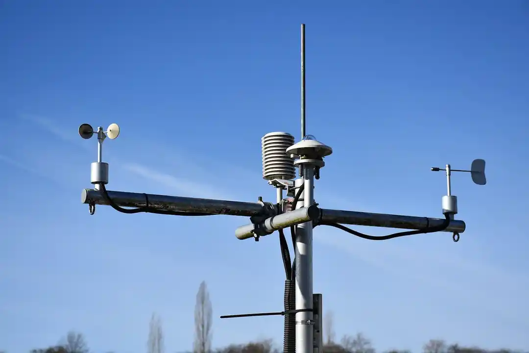
For centuries, forecasting was based on observation—reading the clouds, watching the wind, and noting a change in pressure with a barometer. While those skills are still valuable, modern meteorology has been revolutionized by technology. Today, we have an incredible arsenal of tools that give us a comprehensive, real-time view of the entire planet's atmosphere, from the ground up to the edge of space.
It starts with a global network of thousands of weather stations and weather balloons that constantly measure temperature, pressure, humidity, and wind. But the real game-changers are radar and satellites. Weather radar sends out beams of energy to detect precipitation, showing us exactly where it's raining or snowing and how intensely. Satellites orbit high above the Earth, providing that "big picture" view you see on the news, tracking the movement of clouds, hurricanes, and large-scale weather systems across continents and oceans.
All of this immense data—trillions of data points every single day—is fed into some of the most powerful supercomputers in the world. These computers run what are known as Numerical Weather Prediction (NWP) models. These are essentially massive sets of mathematical equations that describe the physical laws of the atmosphere. The models take the current state of the weather and calculate how it will evolve over the next few hours, days, and even weeks. It’s an unbelievably complex simulation of our planet’s climate system.
Even with all this power, there's a reason forecasts aren't perfect. The atmosphere is a chaotic system, meaning a tiny, unobserved change in one place can lead to big differences in the forecast down the line (sometimes called the "butterfly effect"). That’s why meteorologists don't rely on just one model; they look at many different ones and use their own expertise to make the final call. It’s a beautiful blend of raw computational power and human experience.
So, the next time you check the weather on your phone, take a moment to appreciate the incredible science behind it. It’s not magic; it’s the result of a deep understanding of our planet's amazing atmospheric engine, powered by a constant flow of data and the brilliant minds who interpret it. It’s a puzzle that connects us all, and one that we get a little better at solving every single day.
You might also like

The Pressure Is Real: How to Increase Your Income and Tackle Student Loans Head-On
Feeling crushed by student loan payments? It’s a feeling many of us know. Let's move beyond just budgeting and explore real, actionable strategies to boost your income and regain financial control.

How to Meal Prep on a Budget: Your Guide to Eating Well for a Week
Tired of expensive takeout and last-minute dinner stress? Discover how to master the art of meal prepping for a week on a budget. It's easier than you think and will change your relationship with food and your finances.

More Than a Ball Drop: New Year's Rituals Around the World That Will Amaze You
Ever wonder how other cultures ring in the New Year? From smashing plates to carrying empty suitcases, let's explore some of the most unique and meaningful traditions from across the globe.

The Future of Money is Already Here: 4 Fintech Trends You Can't Ignore
Ever feel like the way we handle money is changing at lightning speed? You're not wrong. From AI advisors to finance that's baked right into your favorite apps, let's break down the biggest shifts in fintech.

Is Gold the Unsung Hero of Your Retirement Strategy?
We all dream of a secure retirement. But in a world of volatile markets, where does a timeless asset like gold fit into a modern long-term plan? Let's explore.